


Accelerating the GEOINT Pipeline: From Collection to Decision
 By Loren Blinde
September 21, 2026
By Loren Blinde
September 21, 2026

From IC Insider Everforth ECS
Your geospatial intelligence (GEOINT) teams don’t have a data problem. They have a speed-to-delivery problem.
More sensors are coming online all the time. Imagery volumes continue to grow. AI tools add even more information to process, increasing the demand for real-time processing and inference. But, getting from that data to a decision still takes too long. Delays build when data is hard to access, systems don’t connect, or AI models aren’t ready for real-world use.
The result? Analysts wait. Decisions lag. Mission timelines slip.
As federal acquisition priorities shift toward speed and measurable delivery, GEOINT systems must do more than collect and analyze data. They must reduce friction across the pipeline so insights move from collection to decision in near real time.
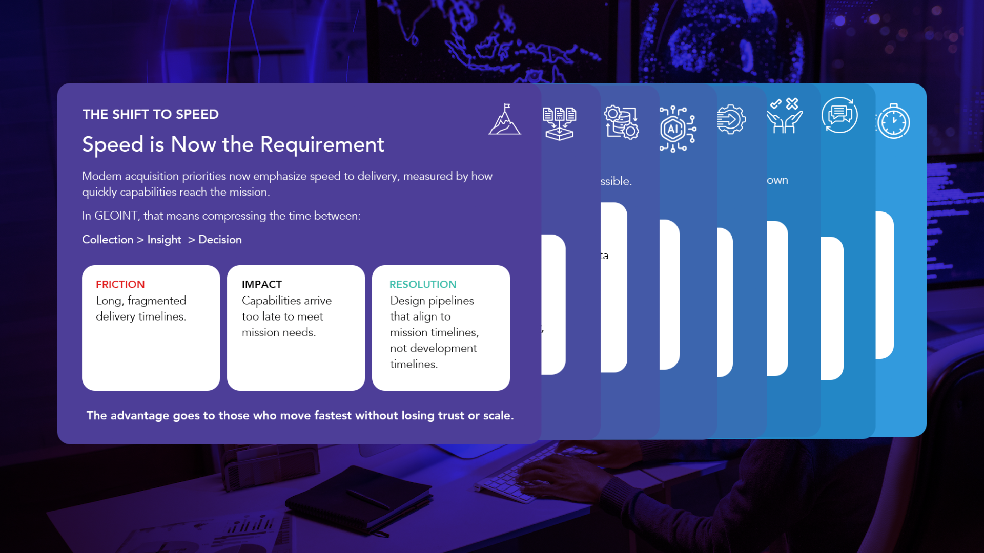
Explore the full infographic to walk through the seven places GEOINT pipelines slow down.
Speed Is Now the Requirement
Modern acquisition priorities emphasize faster delivery and adoption. The measure that matters is how quickly capabilities reach the mission and become part of operational workflows.
For GEOINT, that means compressing the path from collection to insight to decision. Long, fragmented timelines can result in capabilities arriving too late to meet mission needs. Pipelines instead need to align to mission timelines rather than development timelines.
The advantage goes to those who can move fastest without losing trust or scale. But, speed cannot be added at the end of the process. It has to be built into every stage.
Start With Multi-Source Collection
GEOINT collection spans imagery and motion video alongside a growing universe of open-source and other data. However, more data doesn’t automatically lead to better outcomes.
Siloed sources and inconsistent formats make that abundance harder to use, while delayed access adds another barrier. As new sensors and sources come online, the problem compounds.
Unifying ingestion across multi-source GEOINT helps make data usable immediately, rather than eventually. When inputs don’t connect, delays begin at the very start of the pipeline.
Make Data Ready for AI
Before data can power analytics or AI, it must be ready to use. Manual processing and fragmented workflows create a bottleneck, while poor data readiness can stall AI and analytics before they even start.
Automating processing and data fusion creates mission-ready inputs at scale, helping AI operate without unnecessary delay. Less manual work here means more speed everywhere downstream.
Get AI Into Operational Environments
AI has the potential to accelerate GEOINT, but only if it reaches the mission.
Obstacles to that goal can range from limited portability to models simply spending too long in development or validation. Closing this gap requires teams to continuously validate and update models while deploying them into real-world environments.
In short, AI must be built for deployment, not just development.

Design for Interoperability
GEOINT systems don’t operate in isolation. Data and models have to work with the tools and environments already supporting the mission.
Disconnected systems and poor interoperability break that flow, and vendor lock-in can make the problem even worse. Designing for interoperability from the start allows new capabilities to integrate and scale without unnecessary delay.
Interoperability-integration is what turns capability into speed.
That becomes even more important as organizations introduce new sensors and commercial technology into existing mission environments. Speed to delivery also requires speed to integrate.
Put Insights Where Decisions Happen
The pipeline ultimately has to serve the user.
Outputs that arrive late or don’t fit existing workflows slow decisions. Even timely analysis has limited value when users cannot readily apply it within their operational environment.
Delivering insights directly into existing workflows removes another handoff between analysis and action.
The goal is simple: get the right insight to the right user when it matters.
Keep the Pipeline Moving
The pipeline doesn’t end at the decision.
Mission needs don’t stay static, and neither can GEOINT systems. Without feedback from real-world use, models and workflows can and will fall behind evolving requirements. Thus, user feedback should feed directly into continuous improvement, allowing capabilities to evolve at mission speed:
Field → Learn → Improve → Repeat
Accelerating GEOINT Delivery
The constraint on GEOINT delivery is often the friction connecting infrastructure to workflows and technology to users. Those bottlenecks and breakdowns can slow the entire mission lifecycle.
Removing them accelerates capability from initial collection through operational decision making. In other words, modern GEOINT advantage ultimately comes from accelerating delivery, not just advancing technology.
Everforth ECS already operates with this model today. We build scalable pipelines that connect data and AI to mission systems, reducing friction and bringing mission-ready capabilities to users faster.
Learn more about Everforth ECS’ GEOINT AI capabilities and connect with our experts.
About Everforth ECS
Everforth ECS, the Federal Government Segment of Everforth, is a trusted mission operations partner helping government agencies deliver measurable outcomes through advanced technology solutions, including AI, cybersecurity, digital engineering, and enterprise modernization. By bringing together deep mission expertise, proven processes, and the right technologies, Everforth ECS helps customers accelerate decision making, strengthen resilience, and modernize the systems that power the government’s most critical missions. For more information, visit www.everforthecs.com.
About IC Insiders
IC Insiders is a special sponsored feature that provides deep-dive analysis, interviews with IC leaders, perspective from industry experts, and more. Learn how your company can become an IC Insider.