

First shortwave infrared images taken with Exelis system on DigitalGlobe’s WorldView-3 satellite released
 The Exelis-built shortwave infrared imager (SWIR) on DigitalGlobe’s WorldView-3 satellite cut through a thick cloud of smoke to capture images of an active forest fire, marking the first time this capability has been commercially available from a satellite platform.
“These images show how SWIR technology can directly benefit firefighters and help save lives”
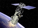
Exelis built the integrated, super-spectral imaging system, which includes a telescope, sensor and SWIR system, for the WorldView-3 satellite. This effort is a part of the Exelis strategic focus on advancing intelligence, surveillance, reconnaissance and analytics technologies. The advanced imaging system is the first of its kind on a high-resolution commercial imaging satellite and allows DigitalGlobe to expand its imagery product offerings to now include images taken through smoke or other atmospheric conditions. The satellite launched in August from Vandenberg Air Force Base in California and is now in orbit 617 kilometers above Earth.
Taken above the Happy Camp complex in California’s Klamath National Forest, the images show an active fire beneath a thick cloud of smoke. Hot spots are clearly visible even without being shown at full resolution.
“These images show how SWIR technology can directly benefit firefighters and help save lives,” said Rob Mitrevski, vice president and general manager of Exelis Geospatial Systems. “SWIR can remove some of the guesswork in determining where hot spots are to help firefighters plan their approach. SWIR can also benefit other areas and industries where the need for accurate imaging through haze, fog, dust, smoke and other airborne particulates is important.”
WorldView-3 capabilities will help solve tough customer problems across a variety of applications, including accurate crop mapping; efficient site selection, exploration and environmental monitoring for the energy industry; and mineral identification and chemical measurements to support mining.
Other imaging systems provided by Exelis include those on DigitalGlobe’s IKONOS, QuickBird, WorldView-1, GeoEye-1 and WorldView-2 satellites. DigitalGlobe’s WorldView-4 satellite, planned for launch in mid-2016, will also carry an Exelis-built imager.